In Saskatoon, we see it all the time — a perfectly stable-looking slope along the South Saskatchewan River suddenly showing tension cracks after a heavy spring thaw. This city sits on some of the most complex glacial stratigraphy in the Prairies, and the combination of steep riverbank cuts, variable till deposits, and seasonal groundwater fluctuations creates a genuine challenge for any development near the valley edges. A desk study alone will not cut it here. Our team runs site-specific slope stability analysis that factors in the real shear strength of the local Battleford till, not just textbook values. We sample the exact stratigraphy, run consolidated-undrained triaxial on the clay layers, and model pore pressure conditions that reflect Saskatoon's freeze-thaw reality. When a project involves a cut deeper than about 3 meters in the Lake Agassiz basin sediments, we integrate the results with in-situ permeability testing to understand drainage behavior before finalizing the factor of safety.
A reliable factor of safety for a Saskatoon riverbank slope changes drastically between April and August — we model both extremes.
Technical details of the service in Saskatoon
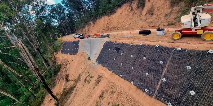
Typical technical challenges in Saskatoon
We run the analysis on a workstation loaded with proprietary slope modeling software, but the machine is only as good as the field data it receives. The biggest risk we see in Saskatoon is not the calculation itself — it is underestimating the perched water tables that form in the upper weathered till after snowmelt. A slope that calculates a factor of safety of 1.7 in September can drop below 1.3 in April if the drainage is not properly characterized. Our field crews install vibrating-wire piezometers in the boreholes during site investigation, and we monitor them through at least one full seasonal cycle before finalizing the long-term design parameters. Another common failure trigger here is excavation at the toe without adequate benching or shoring; the stress relief causes progressive failure that starts at the bottom and retrogresses upward rapidly. We address this by modeling staged construction sequences and specifying temporary cut angles that account for the local till's preconsolidation history.
Our services
Our slope stability analysis in Saskatoon is backed by a full suite of field investigation and laboratory testing capabilities. We do not outsource the critical parameter measurements; everything runs through our ISO 17025-accredited lab right here in the region.
Static and Pseudo-Static Stability Modeling
Full limit equilibrium analysis for natural slopes, engineered cuts, and embankments on Saskatoon's glacial till. We include rapid drawdown scenarios for riverbank sites and pseudo-static seismic checks using NBCC-specified coefficients. Each report delivers critical slip surfaces, sensitivity to pore pressure, and explicit factor of safety against both circular and block-type failure modes.
Field Instrumentation and Monitoring Program Design
Installation of standpipe and vibrating-wire piezometers, slope inclinometers, and survey monuments to track real-time movement. We design monitoring plans that capture the critical spring melt period when most instability in the Saskatoon area manifests, feeding live data back into the stability model for observational method adjustments.
Top questions
What factor of safety is required for a permanent slope in Saskatoon under NBCC?
For permanent static conditions, NBCC and standard Canadian geotechnical practice require a minimum factor of safety of 1.5. Under pseudo-static seismic loading, the minimum drops to 1.1 using a site-specific horizontal acceleration coefficient, typically between 0.05 and 0.10 for Saskatoon depending on site class and proximity to the river valley amplification zone.
What does slope stability analysis cost for a typical residential lot near the riverbank?
For a single residential lot on a Saskatoon riverbank slope, the full package — including site investigation, laboratory testing, and stability analysis report — typically ranges from CA$1.720 to CA$6.560 depending on access conditions, number of boreholes required, and whether piezometer monitoring is included. Multi-season monitoring programs fall at the higher end.
How long does it take to get results from a slope stability study?
Fieldwork and laboratory testing usually take two to three weeks from mobilization. If seasonal groundwater monitoring is specified, we typically recommend at least one full spring melt cycle, which means the final report may be delivered approximately six to eight months after initial investigation, depending on when drilling starts.